Moulin Brûlé means ‘burnt mill’. Guests often ask us where that mill stood. Good question. So we went through old maps of Agnac, from the 18th century to today.
What the maps show
- Around 1770 the Cassini map, the first map of the whole of France, calls our hill ‘le Chabeau’. It shows two mills nearby: the water mill of Agnac on the Dropt, and a windmill on the hill near La Forêt, about 2 km south of us.
- In 1835 the land register map names our fields ‘Chateau’ and ‘au Boiret’. There are a few farm buildings, but no mill.
- Around 1850 the army staff map writes ‘Chauteau’. Our street still carries that name: Impasse du Chauteau.
- In 1950 the IGN map still says ‘Chauteau’. The windmill to the south appears as ‘Moulin de la Nauve’. Today it is ‘le Moulin de Lanauve’, on a 133 m hilltop.
- Today ‘le Moulin Brûlé’ is on the map, right where the campsite is. In the land register, too, the campsite’s meadows are officially called ‘Moulin Brûlé’.
So where was the mill?
We don’t know (yet). We have found no trace of a mill on our own land. Still, ‘Moulin Brûlé’ is a real field name in the land register, and such names are often very old. Our ridge would have been a fine spot for a windmill. Perhaps a mill burned down here long before anyone put it on a map. Perhaps the name points to the windmill on the next hill. The answer is probably in the archives in Agen. Do you know more? We’d love to hear it at the honesty bar.
The maps
Camping Moulin Brûlé the windmill hill of la Nauve / Lanauve
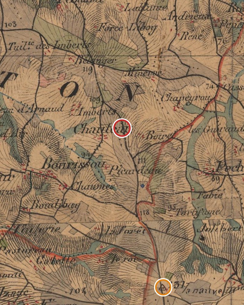
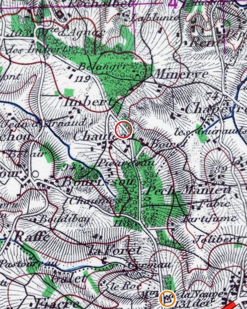
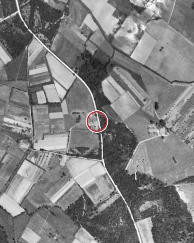
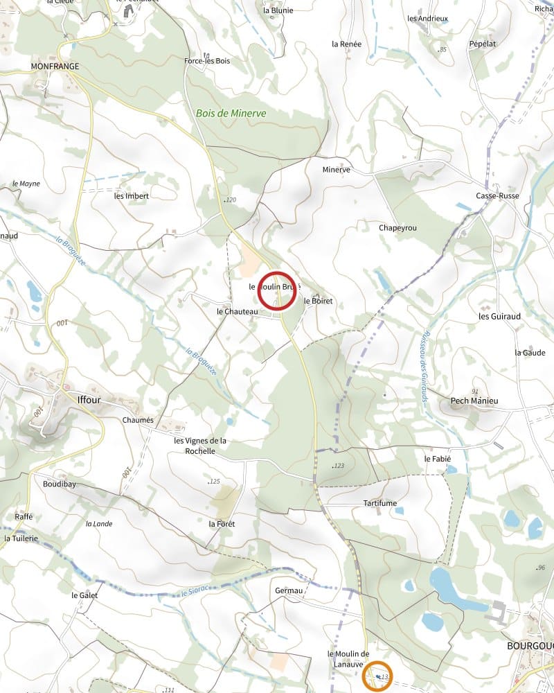
Maps: © IGN (Géoplateforme, cartes.gouv.fr), Licence Ouverte. Also consulted: Carte de Cassini (BnF/IGN) and the 1835 land register of Agnac (Archives départementales de Lot-et-Garonne, E DEPOT 003/1G1).